
Pander's Ground Jay
Podoces panderi
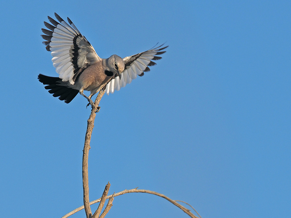
The Turkestan ground jay, grey ground jay or Pander's ground-jay (Podoces panderi) is a species of bird in the crow and jay family, Corvidae.
- Kingdom
- Animalia
- Phylum
- Chordata
- Class
- Aves
- Order
- Passeriformes
- Family
- Corvidae
- Genus
- Podoces
- Species
- Podoces panderi
Description
The Turkestan ground jay, grey ground jay or Pander's ground-jay (Podoces panderi) is a species of bird in the crow and jay family, Corvidae. It is found in central Asia, particularly Kazakhstan, Turkmenistan, and Uzbekistan. More specifically, they tend to be found in Astragalus, Calligonum and southern Salsola vegetation zones. It is closely related to the Iranian ground jay. Its natural habitat is sandy desert with low shrub cover. It also forages around human settlements and roads.
Gallery
Ajouter des photos
Partagez vos photos de cette espèce (jusqu'à 20 à la fois) : elles sont vérifiées automatiquement, puis publiées.
Répartition
Occurrences observées (données GBIF). Les zones hors aire d'origine peuvent indiquer une présence introduite ou invasive.
Sources et crédits
Informations provenant de plusieurs sources vérifiées. Dernière mise à jour : .
Crédits photos (8)
- Photo : James Eaton (@james_birdtourasia) · CC0 (domaine public) · via iNaturalist
- Photo : @errror44 · CC BY-NC 4.0 · via iNaturalist
- Photo : @syrymbet · CC BY-NC 4.0 · via iNaturalist
- Photo : Shakhzod Dekhkonov (@shakhzod1994) · CC BY-NC 4.0 · via iNaturalist
- Photo : Curren Frasch (@currenfrasch) · CC BY-NC 4.0 · via iNaturalist
- Photo : Andrew Bazdyrev (@andrewbazdyrev) · CC BY 4.0 · via iNaturalist
- Photo : Светлана Стрижова (@svstrizh) · CC BY-NC 4.0 · via iNaturalist
- Photo : Beta Wildlife (@beta_wildlife) · CC BY-NC 4.0 · via iNaturalist
Mentions de licence
Texte disponible sous licence CC BY-SA 4.0. Il adapte notamment Wikipedia (CC BY-SA) : Turkestan ground jay, Podoce de Pander (Wikipédia, auteurs dans l’historique de l’article).
- Taxonomie : GBIF Backbone Taxonomy (CC BY 4.0)
- Carte : occurrences GBIF, fond © contributeurs OpenStreetMap (ODbL)
- Statut de conservation : Liste rouge de l'UICN, via Wikidata (CC0)
Détail : Sources et licences.
Discussion (0)
Aucun message pour l’instant. Lancez la discussion sur cette fiche (sources, précisions, débats éditoriaux).
Connectez-vous pour participer à la discussion.