
Inland Dotterel
Peltohyas australis
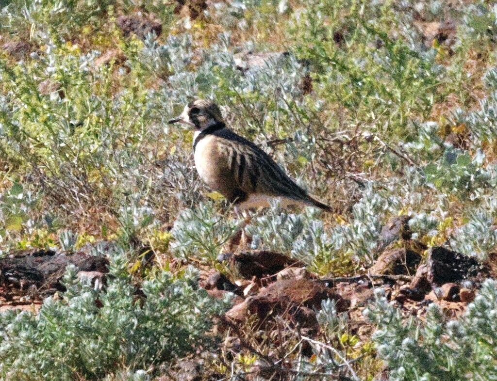
The inland dotterel or inland plover (Peltohyas australis) is an endemic bird of the arid Australian interior.
- Kingdom
- Animalia
- Phylum
- Chordata
- Class
- Aves
- Order
- Charadriiformes
- Family
- Charadriidae
- Genus
- Peltohyas
- Species
- Peltohyas australis
Description
The inland dotterel or inland plover (Peltohyas australis) is an endemic bird of the arid Australian interior. It forms loose flocks in sparsely vegetated gibber plain and claypans in the day where it loafs in the shade and eats shoots of shrubs. It is most often encountered at night when it forages on roads for insects. The relative remoteness of its habitat means that it is not well studied. The most detailed observations of the species were made by the South African arid-zone ornithology specialist Gordon Maclean in the 1970s. Alternate English names include Australian plover, inland plover, desert plover and prairie plover.
Gallery
Ajouter des photos
Partagez vos photos de cette espèce (jusqu'à 20 à la fois) : elles sont vérifiées automatiquement, puis publiées.
Répartition
Occurrences observées (données GBIF). Les zones hors aire d'origine peuvent indiquer une présence introduite ou invasive.
Sources et crédits
Informations provenant de plusieurs sources vérifiées. Dernière mise à jour : .
Crédits photos (8)
- Photo : Eddy Smith (@creature-logger) · CC BY-NC 4.0 · via iNaturalist
- Photo : Christine Heiser (@christineheiser) · CC BY-NC 4.0 · via iNaturalist
- Photo : Phil Barron (@philby101) · CC BY-NC 4.0 · via iNaturalist
- Photo : @coanne · CC BY-NC 4.0 · via iNaturalist
- Photo : John Sterling (@jsterling60) · CC BY-NC 4.0 · via iNaturalist
- Photo : Jordan Aquilina (@jordanaquilina) · CC BY-NC 4.0 · via iNaturalist
- Photo : Mikael Bauer (@neomorphus) · CC BY-NC 4.0 · via iNaturalist
- Photo : Bird Explorers (@birdexplorers) · CC BY-NC 4.0 · via iNaturalist
Mentions de licence
Texte disponible sous licence CC BY-SA 4.0. Il adapte notamment Wikipedia (CC BY-SA) : Inland dotterel (Wikipédia, auteurs dans l’historique de l’article).
- Taxonomie : GBIF Backbone Taxonomy (CC BY 4.0)
- Carte : occurrences GBIF, fond © contributeurs OpenStreetMap (ODbL)
- Statut de conservation : Liste rouge de l'UICN, via Wikidata (CC0)
Détail : Sources et licences.
Discussion (0)
Aucun message pour l’instant. Lancez la discussion sur cette fiche (sources, précisions, débats éditoriaux).
Connectez-vous pour participer à la discussion.