
Eastern short-eared rock-wallaby
Petrogale wilkinsi
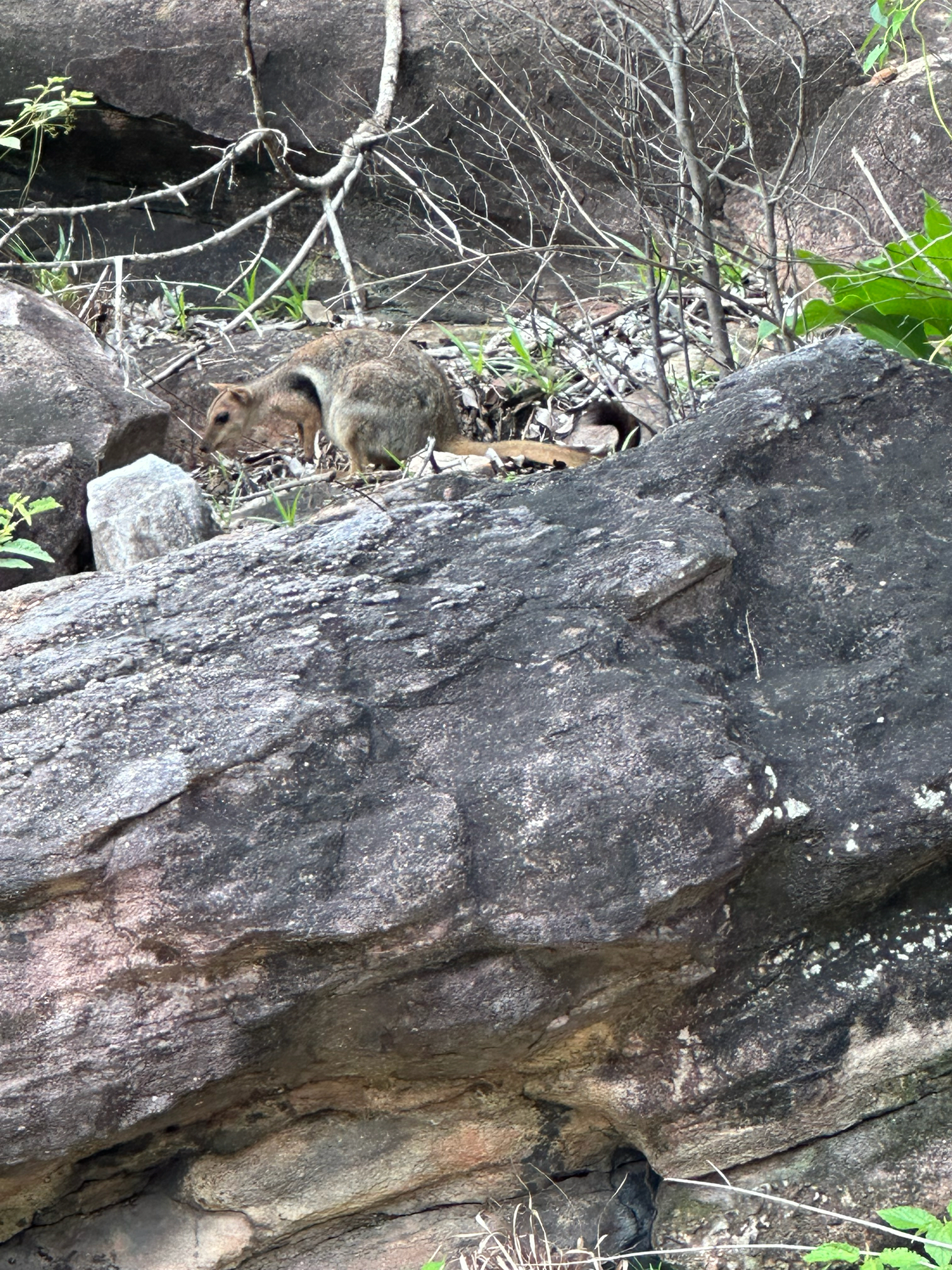
The eastern short-eared rock-wallaby or Wilkins' rock-wallaby (Petrogale wilkinsi) is a species of rock-wallaby found in the northernmost parts of the Northern Territory of Australia, and is common in the Kakadu and Litchfield National…
- Kingdom
- Animalia
- Phylum
- Chordata
- Class
- Mammalia
- Order
- Diprotodontia
- Family
- Macropodidae
- Genus
- Petrogale
- Species
- Petrogale wilkinsi
Description
The eastern short-eared rock-wallaby or Wilkins' rock-wallaby (Petrogale wilkinsi) is a species of rock-wallaby found in the northernmost parts of the Northern Territory of Australia, and is common in the Kakadu and Litchfield National Parks. It was thought to be a subpopulation of the short-eared rock-wallaby Petrogale brachyotis found in the Kimberley (Western Australia), but recent genetic and morphological studies have shown it to be distinct. Wilkins' rock-wallaby is smaller, has more distinct grey/brown markings on its head and sides, and more colourful limbs than the western species.
Gallery
Ajouter des photos
Partagez vos photos de cette espèce (jusqu'à 20 à la fois) : elles sont vérifiées automatiquement, puis publiées.
Répartition
Occurrences observées (données GBIF). Les zones hors aire d'origine peuvent indiquer une présence introduite ou invasive.
Sources et crédits
Informations provenant de plusieurs sources vérifiées. Dernière mise à jour : .
Crédits photos (6)
- Photo : Sherie Bruce · CC BY-NC 4.0 · via GBIF
- Photo : @axeholmes · CC BY-NC 4.0 · via iNaturalist
- Photo : John Sullivan (@jcsullivan) · CC BY-NC 4.0 · via iNaturalist
- Photo : Philipp (@phklsch) · CC BY-NC 4.0 · via iNaturalist
- Photo : Jenny Donald (@jadonald) · CC BY-NC 4.0 · via iNaturalist
- Photo : 金翼白眉 (@luoycy) · CC BY-NC 4.0 · via iNaturalist
Mentions de licence
Texte disponible sous licence CC BY-SA 4.0. Il adapte notamment Wikipedia (CC BY-SA) : Eastern short-eared rock-wallaby (Wikipédia, auteurs dans l’historique de l’article).
- Taxonomie : GBIF Backbone Taxonomy (CC BY 4.0)
- Carte : occurrences GBIF, fond © contributeurs OpenStreetMap (ODbL)
- Statut de conservation : Liste rouge de l'UICN, via Wikidata (CC0)
Détail : Sources et licences.
Discussion (0)
Aucun message pour l’instant. Lancez la discussion sur cette fiche (sources, précisions, débats éditoriaux).
Connectez-vous pour participer à la discussion.