
Chital
Axis axis
The chital (Axis axis; ), also called spotted deer and axis deer, is a deer species native to the Indian subcontinent.
- Kingdom
- Animalia
- Phylum
- Chordata
- Class
- Mammalia
- Order
- Artiodactyla
- Family
- Cervidae
- Genus
- Axis
- Species
- Axis axis
Description
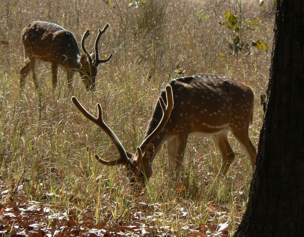
The chital (Axis axis; ), also called spotted deer and axis deer, is a deer species native to the Indian subcontinent. It was first described by Johann Christian Polycarp Erxleben in 1777. A moderate-sized deer, male chital reach 90 cm (35 in) and females 70 cm (28 in) at the shoulder. While males weigh 70–90 kg (150–200 lb), females weigh around 40–60 kg (88–132 lb). It is sexually dimorphic; males are larger than females, and antlers are present only on males. The upper parts are golden to rufous, completely covered in white spots. The abdomen, rump, throat, insides of legs, ears, and tail are all white. The antlers, three-pronged, are nearly 1 m (3 ft 3 in) long.
Gallery
Ajouter des photos
Partagez vos photos de cette espèce (jusqu'à 20 à la fois) : elles sont vérifiées automatiquement, puis publiées.
Répartition
Occurrences observées (données GBIF). Les zones hors aire d'origine peuvent indiquer une présence introduite ou invasive.
Sources et crédits
Informations provenant de plusieurs sources vérifiées. Dernière mise à jour : .
Crédits photos (8)
- Photo : Phil Benstead (@philbenstead) · CC BY-NC 4.0 · via iNaturalist
- Photo : Ashwin Viswanathan (@ashwinv) · CC BY 4.0 · via iNaturalist
- Photo : swanand kesari (@swanand) · CC BY-NC 4.0 · via iNaturalist
- Photo : Becky Brenner (@jbecky) · CC BY-NC 4.0 · via iNaturalist
- Photo : @shivaprakash · CC BY-NC 4.0 · via iNaturalist
- Photo : @pattabi · CC BY-NC 4.0 · via iNaturalist
- Photo : @n_armstrong · CC0 (domaine public) · via iNaturalist
- Photo : @kelptaylor · CC BY-NC 4.0 · via iNaturalist
Mentions de licence
Texte disponible sous licence CC BY-SA 4.0. Il adapte notamment Cerf axis, Wikipedia (CC BY-SA) : Chital (Wikipédia, auteurs dans l’historique de l’article).
- Taxonomie : GBIF Backbone Taxonomy (CC BY 4.0)
- Carte : occurrences GBIF, fond © contributeurs OpenStreetMap (ODbL)
- Statut de conservation : Liste rouge de l'UICN, via Wikidata (CC0)
Détail : Sources et licences.
Discussion (0)
Aucun message pour l’instant. Lancez la discussion sur cette fiche (sources, précisions, débats éditoriaux).
Connectez-vous pour participer à la discussion.