
Ellen Clark's crayfish
Euastacus clarkae
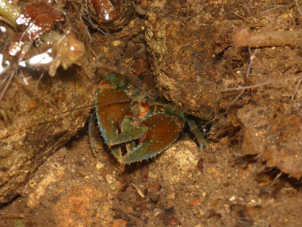
Ellen Clark's crayfish (Euastacus clarkae) was named by Morgan "in respect of Ellen Clark’s pioneering parastacid studies".
- Kingdom
- Animalia
- Phylum
- Arthropoda
- Class
- Malacostraca
- Order
- Decapoda
- Family
- Parastacidae
- Genus
- Euastacus
- Species
- Euastacus clarkae
Description
Ellen Clark's crayfish (Euastacus clarkae) was named by Morgan "in respect of Ellen Clark’s pioneering parastacid studies". It is restricted to headwater reaches of highland streams draining the plateau and feeding the Hastings and Forbes rivers, at elevations ranging from 670–1,150 metres (2,200–3,770 ft) asl. The species is assessed as "Endangered" based on an extent of occurrence (EOO) of 198 square kilometres (76 sq mi), an area of occupancy (AOO) of 68 square kilometres (26 sq mi) occurrence at one to two threat-based locations and a speculated decline in area, extent and quality of habitat due to climate change. This species is fully protected by the Australian government regulations, hence no trade or commercial utilization of the species is allowed. Horwitz and Richardson classified crayfish burrows based on their relationship to the water table, into three categories: Type 1: Burrows in or connected to permanent waters Type 2: Burrows connected to the water table Type 3: Burrows independent of the water table E. clarkae constructs a burrows system according to the location and maturity of the burrow builder, however, all burrows would be within the “Type 1” category with all burrows in, or connected to open water.
Gallery
Ajouter des photos
Partagez vos photos de cette espèce (jusqu'à 20 à la fois) : elles sont vérifiées automatiquement, puis publiées.
Répartition
Occurrences observées (données GBIF). Les zones hors aire d'origine peuvent indiquer une présence introduite ou invasive.
Sources et crédits
Informations provenant de plusieurs sources vérifiées. Dernière mise à jour : .
Crédits photos (3)
- Photo : Ollie Scully (@olliescully1) · CC BY-NC 4.0 · via iNaturalist
- Photo : Daniel (@moocattle) · CC BY-NC 4.0 · via iNaturalist
- Photo : Indra Bone (@indrabone) · CC BY-NC 4.0 · via iNaturalist
Mentions de licence
Texte disponible sous licence CC BY-SA 4.0. Il adapte notamment Wikipedia (CC BY-SA) : Ellen Clark's crayfish (Wikipédia, auteurs dans l’historique de l’article).
- Taxonomie : GBIF Backbone Taxonomy (CC BY 4.0)
- Carte : occurrences GBIF, fond © contributeurs OpenStreetMap (ODbL)
Détail : Sources et licences.
Discussion (0)
Aucun message pour l’instant. Lancez la discussion sur cette fiche (sources, précisions, débats éditoriaux).
Connectez-vous pour participer à la discussion.